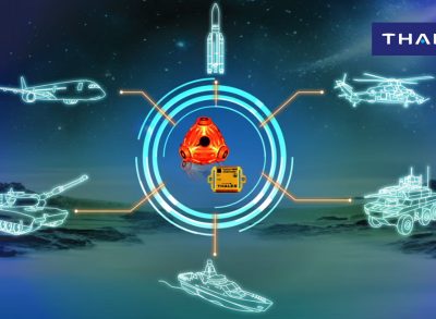
TopAxyz: the only IMU of its kind in the world
The TopAxyz inertial measurement unit (IMU) from Thales is packed with advanced technologies and delivers the performance needed for critical applications in the air, on land and at sea.

More recently, Embraer chose an inertial system from Thales for its KC-390 military transport plane, while ATR now offers a Thales system as an option on its 72-600 series regional airliner to allow RNP 0.3 approaches.
All of these systems are based on the TopAxyz family of IMUs, which comprise a three-axis laser gyroscope in a single, compact monobloc unit for guaranteed performance and an extended lifespan. Its architecture is unlike any other in the world, with two data channels instead of the single channel used by other systems. The navigation channel is dedicated to attitude, heading, airspeed and position calculation. The second "stabilisation" channel is optimised to provide acceleration and rotation inputs with low time lag, low noise and no impact on the bandwidth needed by the fly-by-wire system or the visual sighting instruments and ancillaries.
As a result, the IMU can perform navigation and stabilisation tasks simultaneously and with no trade-off in performance. On an airliner, for example, the pilot no longer has to decide between responsive fly-by-wire manoeuvrability and passenger comfort — the system takes care of both, resulting in a smoother flight all round.
*Required navigation performance (RNP) is a type of performance-based navigation (PBN) that allows an aircraft to fly a specific path between two 3D-defined points in space. RNP also refers to the level of performance required for a specific procedure or a specific block of airspace. An RNP of 10 means that a navigation system must be able to calculate its position to within a circle with a radius of 10 nautical miles. An RNP of 0.3 means the aircraft navigation system must be able to calculate its position to within a circle with a radius of three tenths of a nautical mile.
Find more on the 'Navigation Solutions' here.
Find more on TopAxyz Inertial Measurement Unit here.
Photo: M.Guerra-Thales
Find us on Twitter @thales_avionics, on our official Youtube channel Onboard TV and on LinkedIn Thales Aerospace.


