
Smart mobility: avionics for trains
Building on its experience in air navigation, Thales is helping to solve a puzzle that has intrigued the rail industry for over a decade — how to bring the benefits of satellite positioning to the rail transport sector? This latest collaborative project in the Nouvelle-Aquitaine region promises to make a key contribution to the intelligent transport systems of the future.
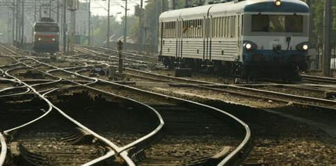
The Kapilarra feasibility study will show whether the levels of safety required for rail signalling can be achieved without relying on the trackside equipment (beacons, axle counters, etc.) used to authorise train movements today. Specifically, this will involve determining how GNSS signals can be incorporated into the latest ERTMS standard (European Railway Traffic Management System).
Automatic guidance and multi-sensor data fusion
The researchers will develop a prototype solution combining some of the automatic GPS-EGNOS guidance technologies developed for civil aviation with the multi-sensor data fusion techniques used in ground-based military navigation systems. One key objective will be to guarantee positioning signal integrity and resistance to masking and multipath conditions on the ground. The solution will be entirely simulated and laboratory-tested using measurements recorded on an actual train line.
Thales is playing a key role on the Kapilarra project, which is an integral part of the digital transformation of the Group's avionics and ground transportation systems businesses. Thales experts are adapting the air navigation architecture to ground-based applications, developing the data fusion algorithm, and drawing on the specialised capabilities of the other project partners — in particular Geosat for standardised high-precision geodetic measurement of the rail tracks, including the geometric characteristics of the rail infrastructure and the surrounding environment. Topos is in charge of administrative and financial management of this collaborative R&D project. Members of the cluster are also providing Galileo positioning equipment and secure data transmission software and helping with hardware integration on board the train.
For the Topos cluster, the project will be an important step towards the creation of the Intelligent Transport Systems (ITS) Living Lab for dedicated sites and traffic circulation systems, which is one of the Nouvelle-Aquitaine region's flagship projects and has strong support from providers of intelligent transport, satellite and geolocation systems and services. The ITS Living Lab will provide an extensive array of services to help policymakers, local authorities and private operators tap into the potential of smart mobility solutions encompassing rail, road and maritime transport as well as connected cars and autonomous vehicles.
Stay connected with us...
Find us on Twitter @ThalesAerospace, on our official Youtube channel Thales Aerospace and on LinkedIn Thales Aerospace.